U.S. Corn Production Maps by State, 1960–2026
Corn harvested for grain, measured in bushels. Compare United States state maps from 1960–2026, measured in bushels of corn, using USDA NASS Quick Stats.
Latest map
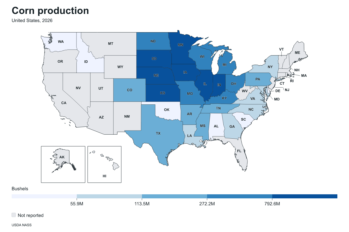
Corn harvested for grain, measured in bushels. Corn production by state in United States, 2026. Measured in bushels of corn. Source: USDA National Agricultural Statistics Service (NASS). Highest reported values: Iowa: 2,803,200,000 bushels of corn; Illinois: 2,288,550,000 bushels of corn; Nebraska: 1,700,970,000 bushels of corn.
Historical years
Explore 67 editions from 1960–2026. Each year links to the published figures, leading regions, source attribution, and missing-value notes. Compare the earliest and latest editions below. The source may revise historical estimates.
1960 · Highest reported values: Iowa: 772,541,000 bushels of corn; Illinois: 678,980,000 bushels of corn; Indiana: 350,336,000 bushels of corn.
2026 · Highest reported values: Iowa: 2,803,200,000 bushels of corn; Illinois: 2,288,550,000 bushels of corn; Nebraska: 1,700,970,000 bushels of corn.