
Détails de la carteFermer
North Carolina, United States · Contour
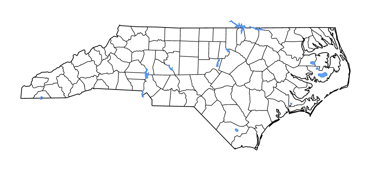
Carte de contour de North Carolina, United States, avec 100 unités cartographiées, les lacs, les cours d’eau.
- Localisation
- United States · Amérique du Nord
- Régions incluses
- 100
- Lacs nommés
- 13
Couches disponibles
- Fond
- Frontières
- Subdivisions
- Lacs
- Rivières
Formats de téléchargement
- svg
- png
Régions incluses (100)
- Alamance
- Alexander
- Alleghany
- Anson
- Ashe
- Avery
- Beaufort
- Bertie
- Bladen
- Brunswick
- Buncombe
- Burke
- Cabarrus
- Caldwell
- Camden
- Carteret
- Caswell
- Catawba
- Chatham
- Cherokee
- Chowan
- Clay
- Cleveland
- Columbus
- Craven
- Cumberland
- Currituck
- Dare
- Davidson
- Davie
- Duplin
- Durham
- Edgecombe
- Forsyth
- Franklin
- Gaston
- Gates
- Graham
- Granville
- Greene
- Guilford
- Halifax
- Harnett
- Haywood
- Henderson
- Hertford
- Hoke
- Hyde
- Iredell
- Jackson
- Johnston
- Jones
- Lee
- Lenoir
- Lincoln
- Macon
- Madison
- Martin
- McDowell
- Mecklenburg
- Mitchell
- Montgomery
- Moore
- Nash
- New Hanover
- Northampton
- Onslow
- Orange
- Pamlico
- Pasquotank
- Pender
- Perquimans
- Person
- Pitt
- Polk
- Randolph
- Richmond
- Robeson
- Rockingham
- Rowan
- Rutherford
- Sampson
- Scotland
- Stanly
- Stokes
- Surry
- Swain
- Transylvania
- Tyrrell
- Union
- Vance
- Wake
- Warren
- Washington
- Watauga
- Wayne
- Wilkes
- Wilson
- Yadkin
- Yancey
Lacs inclus (13)
- Lake Mattamuskeet
- Falls Lake Reservoir
- John H. Kerr Reservoir
- Great Lake
- Lake Gaston
- New Lake
- Lake Waccamaw
- Phelps Lake
- B. Everett Jordan Lake
- Lake Wylie
- High Rock Lake
- Chatuge Lake
- Lake Norman
Chargement de la carte...