Map detailsClose
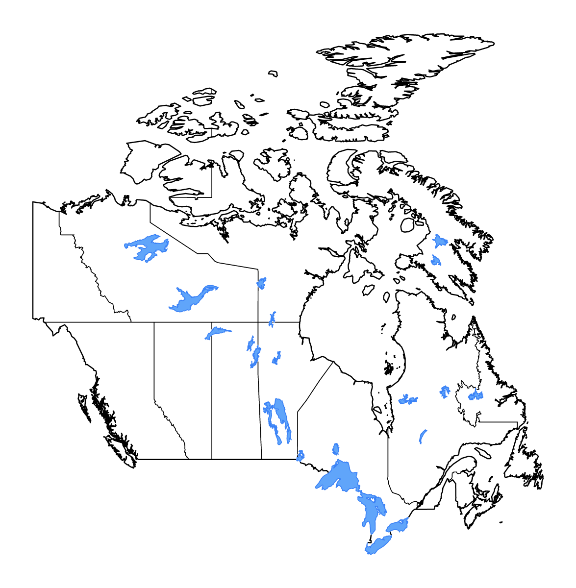
Canada Outline Map
Canada outline map with 13 provinces and territories, lakes, and rivers. Customize colors, borders, and map styles with an interactive editor. Download your finished Canada map in SVG, PNG, or PDF.
Outline map of Canada, showing 13 mapped units and lakes and rivers.
Use this blank map of Canada for geography lessons, presentations, or a printable reference map.
Customize this outline map
- Choose an outline map design, then adjust its colors and line styles.
- Change the land color and the color and thickness of the outer border.
- Adjust internal boundary colors and line widths separately from the outer border.
- Set the map background color or use a transparent background.
- Show or hide the lake layer, select individual lakes, and style their fills and outlines.
- Show or hide the river layer and change river colors and line widths.
- Add place names or notes as text labels, then position and format them on the map.
- Download the outline map as SVG, PNG, or PDF, with canvas dimensions or PDF page settings for your layout.
- Location
- North America
- Regions included
- 13
- Named lakes
- 25
Available layers
- Background
- Borders
- Subdivisions
- Lakes
- Rivers
Download formats
- svg
- png
Use this map for
Customize for free. Download your finished map for USD 1.99.
Download optionsRegions included (13)
- Alberta
- British Columbia
- Manitoba
- New Brunswick
- Newfoundland and Labrador
- Northwest Territories
- Nova Scotia
- Nunavut
- Ontario
- Prince Edward Island
- Quebec
- Saskatchewan
- Yukon
Lakes included (25)
- Lac Mistassini
- Lake Nipigon
- Amadjuak Lake
- Lake Athabasca
- Reindeer Lake
- Lake Winnipeg
- Dubawnt Lake
- Wollaston Lake
- Lake Superior
- Lake Ontario
- Great Bear Lake
- Lake Manitoba
- Great Slave Lake
- Southern Indian Lake
- Lake Erie
- Cedar Lake
- Lake Winnipegosis
- Nueltin Lake
- Lake Huron
- Réservoir La Grande 3
- Smallwood Reservoir
- Réservoir Robert-Bourassa
- Lake of the Woods
- Nettilling Lake
- Réservoir de Caniapiscau
Loading map...